Creative Connections: "Yes, yes, and..." Meets Rubber Duck Debugging

When someone proposes an idea to you, smile and assure them that you understand (yes ...). Express your enthusiasm about it (... yes ...) with an even bigger smile. Then, offer to enhance and extend their great idea (... and ...). You can compare this creativity technique to rubber duck debugging, but always remember that you should not replace a human with an LLM.

Creative Connections:

Seeing the Bigger Picture in Small Details: Birchgletscher’s Collapse

Last week, Switzerland’s Birchgletscher collapsed and caused a major rock avalanches, altering the landscape and burying the village of Blatten. With the data of the federal Rapid Mapping service and the help of individual experts, a first open post-event elevation model was made available. I used the model to create pre- and post-event visualizations and prints at a local scale.

Seeing the Bigger Picture in Small Details: Birchgletscher’s Collapse

Personal News: My First Day at Fotokite

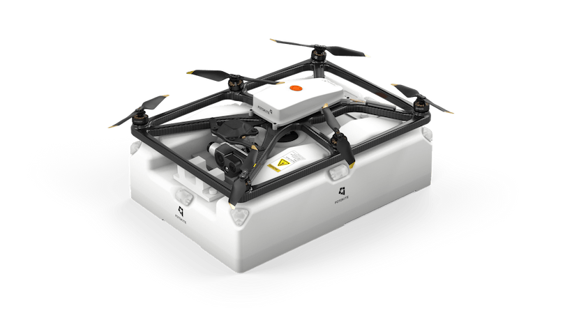
Today marks my first day at Fotokite, a Zurich-based company that designs and manufactures actively tethered UAVs forpublic safety and emergency response. I’ll be leading the application engineering team and am excited to help build a great company with an innovative product.

Personal News: My First Day at Fotokite

One SQL statement to create a web map of Pizza places

The post explores an SQL query using DuckDB and OvertureMaps data to extract, filter, and visualize pizza places in Switzerland. All these steps can be done in one line, and the generated map of Swiss pizza places can be viewed immediately using PMTiles.

One SQL statement to create a web map of Pizza places

Swiss Rooftop Explorer - or how to serve a Low Cost Geo App with no maintenance

The Swiss Rooftop Explorer is a cloud-native web app that retrieves Swiss building roof heights without a GIS server. Using PMTiles, Geoparquet, and DuckDB-WASM, it enables fast, low-maintenance geospatial queries. This post explores the data pipeline and its benefits of cloud-optimized formats, and how static files can replace traditional GIS infrastructure.

Swiss Rooftop Explorer - or how to serve a Low Cost Geo App with no maintenance